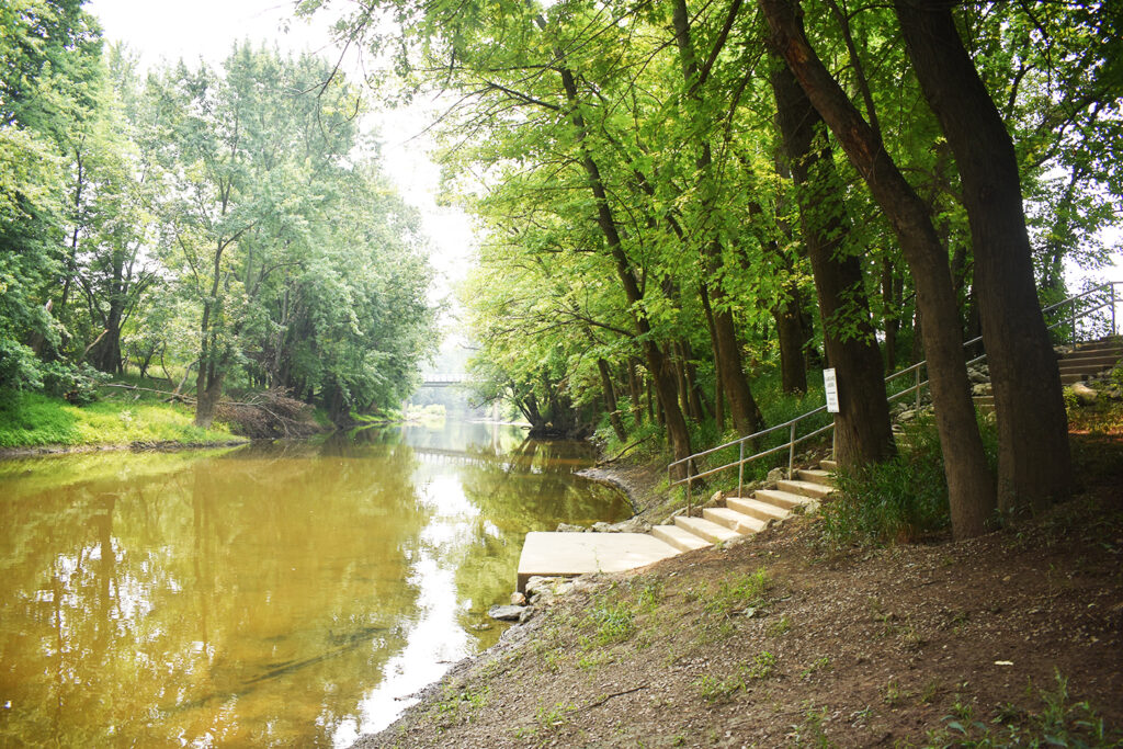
The 37.6-mile Blanchard River Water Trail is predominately a rural waterway that affords relative isolation and solitude. It is characterized by bends, riffles, and forested riverbanks. The urban section flows through Findlay, Ohio. Numerous access points along the way provide a wide range of boating opportunities from short trips lasting an hour or two to half-day and day trips to a two-day trip with primitive tent camping along the Blanchard River at Riverbend Recreation Area.
Location: Unimproved river access at 22006 County Road 17, Forest. Travel south of Mt. Blanchard on CR 17.
River Mile: 84.1
Coordinates: 40.84407 -83.55662
Support Facilities: Small unimproved parking lot and seasonal restroom (portable toilet).
Description: A quiet country setting and scenic start for a day trip to either Riverbend Recreation Area (20.9 miles) or Riverside Park (25 miles), or a two-day trip with overnight tent camping at Riverbend Recreation Area (37.6 miles). Until improvements are made, river access is primitive. Use caution. It may be necessary to drop the canoe or kayak down along the eroded riverbank into the river, secure it, and then drop down into the boat. A ladder may be necessary to assist with loading and launching. Access the river south of the driveway. Follow the signs.
Island Park
River Mile: 77.9
Coordinates: 40.90053 -83.55966
Support Facilities: Developed parking lot and year-round waterless restroom (pit latrine).
Description: An alternative starting point on the Blanchard River Water Trail or a nice place to stop and rest. Access the river approximately 225 feet west of the parking lot along a natural surface and then up and over a steep forested riverbank.

River Mile: 67.2
Coordinates: 40.99228 -83.55674
Support Facilities: Unimproved parking lot and seasonal restroom (portable toilet).
Description: Jackson Landing is a .9-acre natural area located four miles south of Riverbend Recreation Area. It is southeast of the bridge.

U.S. Geological Society River Gage Height and Boating Guideline
The opportunity to paddle the south section of the Blanchard River Water Trail exists for a brief time only. The Blanchard River Water Trail from Blanchard River Nature Preserve to Island Park, Jackson Landing, and Riverbend Recreation Area requires a river gage height of at least four feet before canoeing and kayaking. Flood information can be checked online at www.findlayohio.com – reference site number 04188337. A river gage height of four feet or more typically occurs following a substantial and prolonged rainfall. However, the south section of the Blanchard River drains quickly.
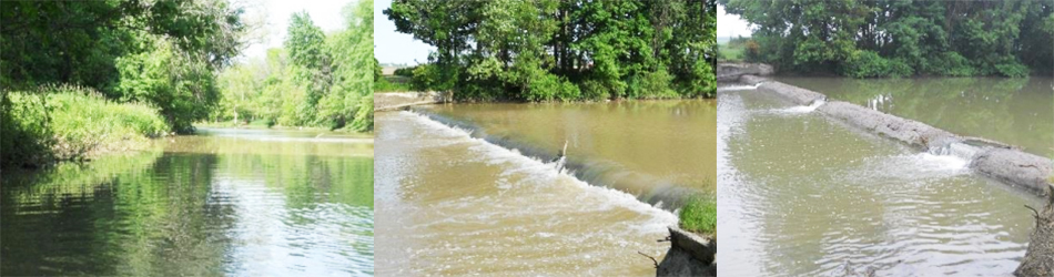
Hazard: Dam near Findlay Reservoir. 41.01625 -83.55869
Portage: Portage on the left side of the Blanchard River. Approximate distance: 100 feet
River Mile: 63.2
Coordinates: 41.03450 -83.56081
Support Facilities: Developed parking lot, year-round waterless restroom (pit latrine), drinking water (seasonal drinking fountain), picnic tables, and a primitive campground for tents only (reservations required) are located in the Big Oaks Activity Area. A pay telephone is available at the Riverbend Maintenance Facility.
Description: Access is located approximately 350 feet from a roadside pull-off on Township Road 241 southeast of the covered bridge. Equipment can be carried to the river along a multi-use asphalt trail followed by a hard surface walkway to the river’s edge.
U.S. Geological Society River Gage Height and Boating Guideline
The Blanchard River Water Trail from Riverbend Recreation Area to the State Route 568 bridge requires a river gage height of at least six feet and five inches before canoeing and kayaking. Flood information can be checked online at www.findlayohio.com – reference site number 04188400.

Hazard: Dam west of Riverbend Recreation Area. 41.03353 -83.57687
Portage: Portage on the left side of the Blanchard River. Approximate distance: 200 feet.
River Mile: 60.5
Coordinates: 41.03802 -83.61284
Support Facilities: Developed parking lot, bench, and picnic tables.
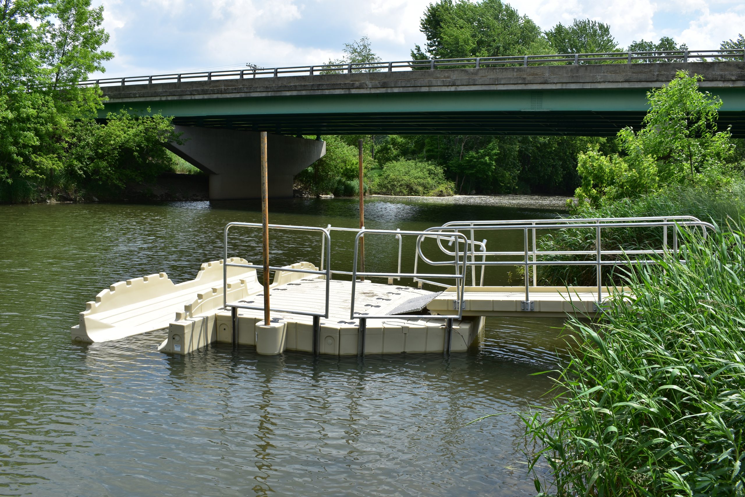
Description: Access is provided by an asphalt boat ramp with concrete edge to aid launching and landing. Eastpoint Area provides easy access to a section of the Blanchard River Water Trail that is navigable year-round. Paddlers can travel upstream beyond Vogelsong Conservation Area to the Sandusky Street/State Route 568 bridge and/or downstream to Zonta Landing at Riverside Park.
U.S. Geological Society River Gage Height and Boating Guideline
If the river gage height is nine feet, the river current upstream and downstream from Eastpoint Area may be too strong to paddle due to flooding or substantial and prolonged rainfall. Flood information can be checked online at www.findlayohio.com – reference site number 04188400.

River Mile: 59.1
Coordinates: 41.04412 -83.63018
Support Facilities: Riverside Park has developed parking lots, restrooms (flush toilets), drinking water (seasonal drinking fountain), and picnic tables.
Description: Zonta Landing at Riverside Park Waterfront is the location of a seasonal boat rental operation managed by the Hancock Park District. Zonta Landing Boat Rentals provide canoes, kayaks, and pedal boats on weekends and holidays, 1:00 p.m. to 7:00 p.m. from Memorial Day weekend through Labor Day – $5 for a ½ hour rental. It also serves as a landing site for paddlers who want to stop for a break, have a picnic, or end a self-guided float trip.
Waterfalls Area
River Mile: 59
Coordinates: 41.04177 -83.63053
Support Facilities: Developed parking lot, bench, picnic table, and landing and launching facilities.
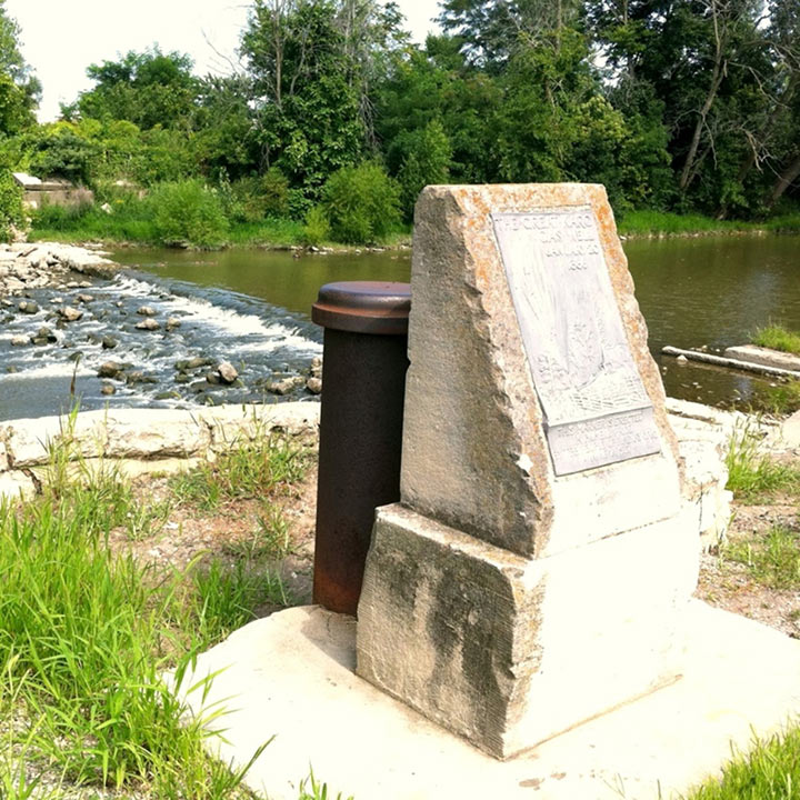
Description: Waterfalls Area serves as a portage at the dam. It also provides easy access to sections of the Blanchard River Water Trail that are navigable year-round. Paddlers can travel downstreamfrom the waterfall or upstream beyond Eastpoint Area and Vogelsong Conservation Area to the Sandusky Street/State Route 568 bridge and back.
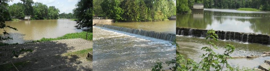
Hazard: Dam near Waterfalls Area and Riverside Park. 41.04181 -83.63127
Portage: Portage on the left side of the Blanchard River. Approximate distance: 500 feet.
Riverside Landing
River Mile: 58.6
Coordinates: 41.04202 -83.63224
Support Facilities: Riverside Park has developed parking lots, restrooms (flush toilets), drinking water (seasonal drinking fountain), and picnic tables.
Description: Access is provided by an asphalt boat ramp with zero depth entry, just south of the parking lot. Riverside Landing provides easy access to the Blanchard River Water Trail and a variety of float trip options ranging from brief excursions to a half-day trip, including Great Karg Well Historical Site (1.1 miles), Liberty Landing (2.9 miles), and Blanchard Landing (12.1 miles).
With ample support facilities, including parking lots and restrooms, and with plenty to do at Riverside Park,
Riverside Landing is a good choice when starting a float trip on the Blanchard River Water Trail.
River Mile: 57.5
Coordinates: 41.04356 -83.65511
Support Facilities: Developed parking lot.
Description: Great Karg Well Historical Site serves as an alternative river access site to Liberty Landing when paddling a popular 9.3-mile route from Liberty Landing to Blanchard Landing, thus adding 1.8 miles to the trip. It also gives paddlers an opportunity to rest before continuing downstream as part of a longer float trip.

River Mile: 55.8
Coordinates: 41.05637 -83.69364
Support Facilities: Developed parking lot, seasonal restroom (portable toilet), and a picnic table.
Description: Liberty Landing marks the beginning of a popular float trip to Blanchard Landing. At 9.3 miles, it is scenic with frequent bends, narrow sections, and exciting riffles with no known hazards. Wildlife sightings are common. Paddlers will pass two bridges and travel along the border of the Indian Green-Worden Family Conservation Area and the south unit of Litzenberg Memorial Woods.

River Mile: 46.5
Coordinates: 41.04610 -83.78857
Support Facilities: Developed parking lot, seasonal restroom (portable toilet), and picnic tables.
Description: Blanchard Landing marks the end of the Blanchard River Water Trail. It also serves as a rest area or starting point for canoeists and kayakers paddling downstream to Gilboa, Ottawa, or to the Auglaize River, the Maumee River, and Lake Erie for a multi-day paddling expedition
River Miles/River Access Sites/Next Site
84.1/ Blanchard River Nature Preserve 6.2 miles
77.9/ Island Park 10.7 miles
67.2/ Jackson Landing 4 miles
63.2/ Riverbend Recreation Area 2.7 miles
60.5/ Eastpoint Area 1.4 miles
59.1/ Zonta Landing at Riverside Park Waterfront .1 mile
59.0/ Waterfalls Area .4 mile
58.6/ Riverside Landing at Riverside Park Waterfront 1.1 miles
57.5/ Great Karg Well Historical Site 1.7 miles
55.8/ Liberty Landing 9.3 miles
46.5/ Blanchard Landing
April, May, and June are the most reliable months to enjoy canoeing and kayaking on the rural sections of the Blanchard River Water Trail as long as there is enough water due to spring rain. The water level is usually too low to paddle during other times of the year unless it is within approximately 72 hours following a substantial and prolonged rainfall. The urban section near Riverside Park and east (upstream) to the State Route 568 bridge is usually navigable all year. For more about Zonta Landing Boat Rentals at Riverside Park Waterfront, Daily Boat Rentals, Group Boat Rentals, and Self-Guided Float Trips in May, September, and October, contact the Hancock Park Department!
Common Hazards
Common Hazard #2: Foot Entrapments Do not attempt to stand or walk in swift-moving water. You may slip and pin a foot between submerged rocks. Once pinned, the force of the current can push your body under water and hold it there. If your boat capsizes, keep your feet up and pointed downstream. Swim to calm water before standing.
Common Hazard #3: Floods and Swift Water Novice paddlers should never boat on the Blanchard River when water is spilling out of the banks. High water causes hazards such as dams to become even more dangerous. Unseen obstacles such as floating logs or submerged trees may also threaten a boater. Know the water conditions before you go. Check conditions online at www.findlayohio.com.
Common Hazard #4: Strainers Obstructions that allow water to flow through, but block boats and persons are known as strainers. Overhanging branches, downed trees, log jams, and flooded islands are potential strainers. Strainers should be avoided, especially in swift water.
Common Hazard #5: Cold Water Immersion and Hypothermia Sudden immersion in cold water can lead to hypothermia within 30 minutes. It can be deadly. The initial cold shock can cause immediate, involuntary gasping, hyperventilation, panic, and vertigo – all of which can result in water inhalation and drowning. It can also cause sudden changes in blood pressure, heart rate, and heart rhythm that also may result in death. The best prevention is to avoid capsizing your boat, keep your life jacket securely fastened, and dress in layers using materials that wick moisture away and retain heat, such as fleece and wool. You do not have to be submerged to succumb to hypothermia – wind chill, rain, and perspiration can contribute to the condition. Uncontrollable shivering, slurred speech, and the lack of coordination are early symptoms of hypothermia.
